
Stamp End: Aerial Photography of Historic Lincoln
The Historic Stamp End Area
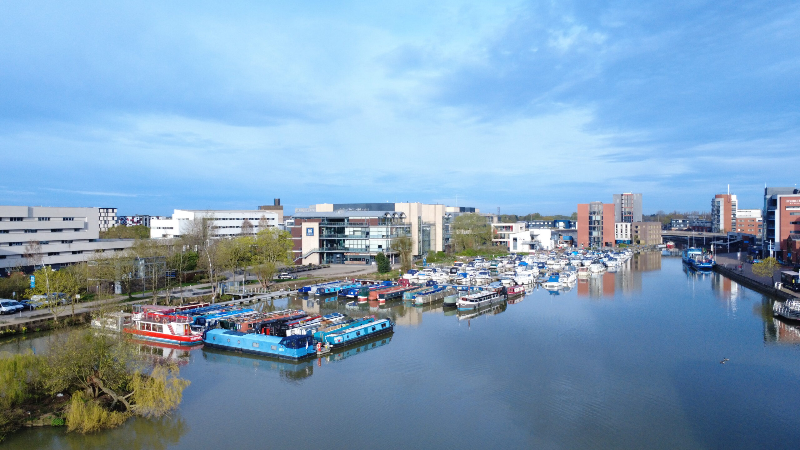
Located on the southern edge of Lincoln, Stamp End has a rich industrial heritage centered around the Fossdyke Navigation and the River Witham. This area has been a vital waterway junction for centuries, connecting Lincoln to the wider canal network.

Lincoln Cathedral and Lincoln College
Dominating the skyline in our aerial photographs is the magnificent Lincoln Cathedral, one of the finest examples of Gothic architecture in Europe. Built between 1072 and 1311, this iconic structure sits atop Lincoln’s limestone cliff and was once the tallest building in the world for over 200 years.
In the cathedral’s shadow, you can see the historic buildings of Lincoln College, part of the city’s educational heritage. The college buildings and surrounding medieval quarter create a stunning backdrop to the industrial waterways below.

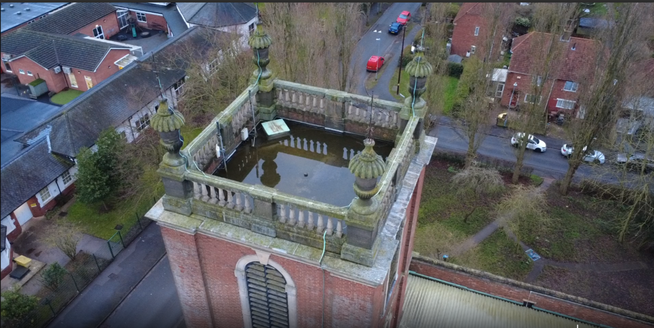
The Lock Mechanism at Stamp End
The most prominent feature in our close-up shots is the Stamp End Lock, a critical piece of navigation infrastructure on the River Witham. This lock system consists of:
The Lock Gates and Chamber
The main lock structure features traditional mitre gates that allow vessels to navigate the change in water level. These gates are operated manually using balance beams, maintaining the traditional methods used for centuries.
The Weir System
Adjacent to the lock, the weir controls water flow and maintains proper levels in the navigation channel. You can see the distinctive cascade of water flowing over the weir structure in several of our images.
Historical Significance
The Fossdyke Navigation
The Fossdyke Navigation, which meets the River Witham at Stamp End, is one of the oldest canals in England, originally constructed by the Romans around 120 AD. It connected Lincoln to the River Trent, making the city a vital inland port.
Medieval Trade Route
Throughout the medieval period, Stamp End was a bustling commercial area where goods were loaded and unloaded from barges. Wool, grain, coal, and other commodities passed through this junction, making it essential to Lincoln’s prosperity.
Industrial Revolution
During the 18th and 19th centuries, the lock system was modernized and the surrounding mills and warehouses were built. The area became a hub of industrial activity, with seed crushing, grain processing, and other industries utilizing the waterway for transport.
20th Century Decline and Preservation
As rail and road transport superseded canal traffic, Stamp End’s commercial importance declined. However, the lock and historic structures have been preserved, and the area is now valued for its heritage and recreational use.

0 Comments